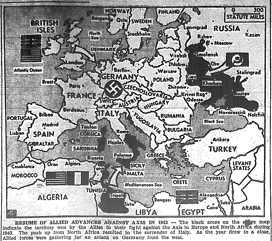
Map of 1943 Allied Conquests, published January 1, 1944
The Charlotte News-- Maps of Central Europe, Published in 1944
| Maps of June-July, 1944| Maps of August| Maps of September-October| Maps of November-December|
|Russian Front Maps | Maps of Italy | Pacific War Maps |
|Large Area Atlas View of Europe, February, 1944|
Map of 1943 Allied Conquests, published January 1, 1944
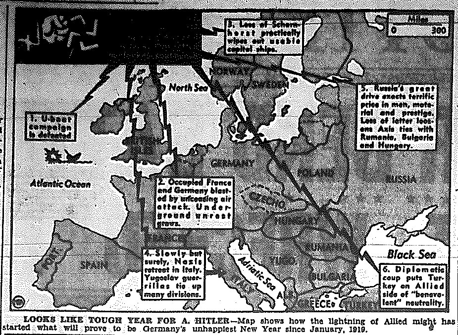
Map of Prospective European Conquests, published January 5, 1944
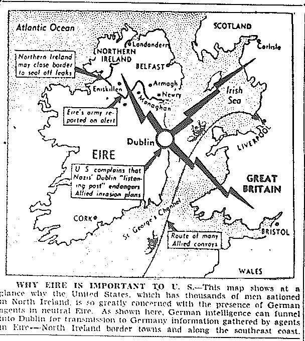
Map of Ireland, published March 13, 1944
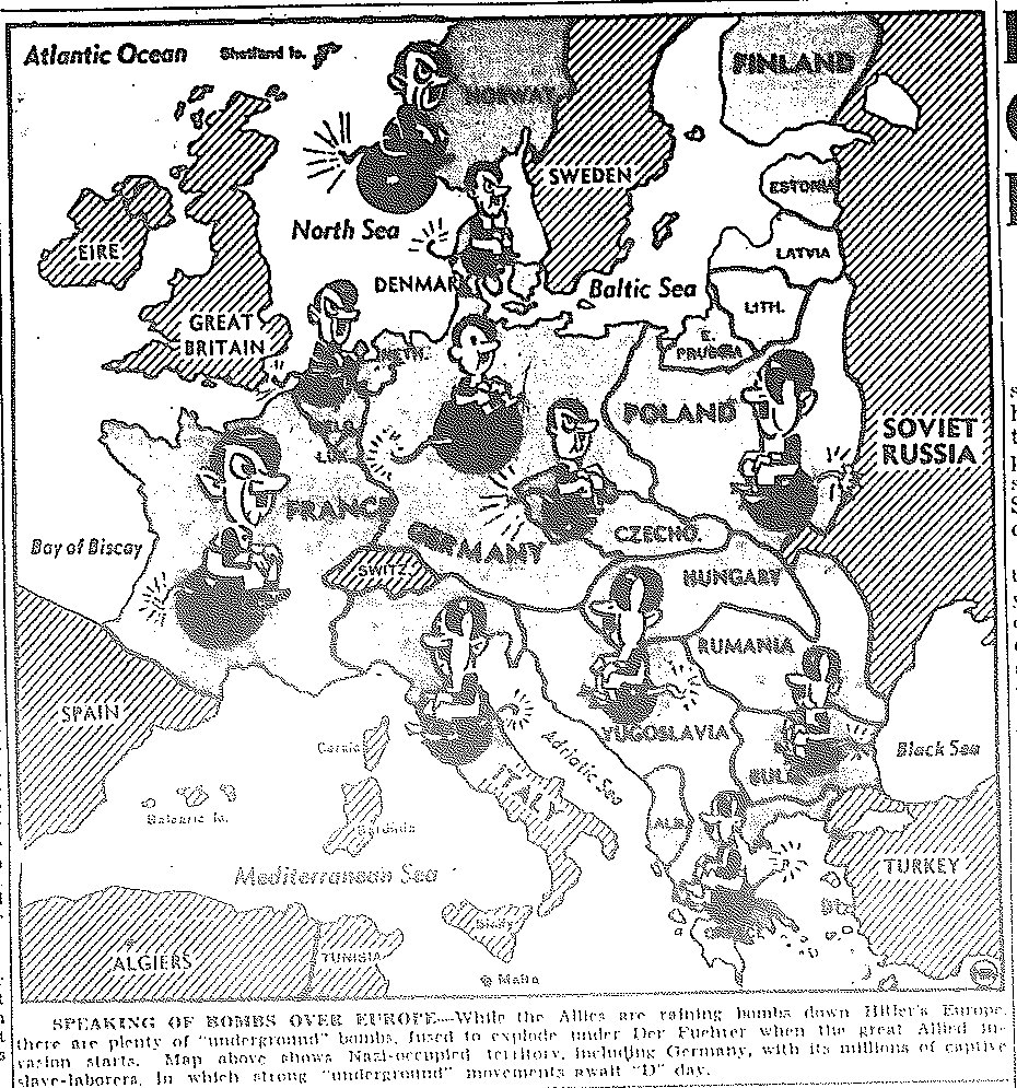
Map of Occupied Europe, published March 18, 1944
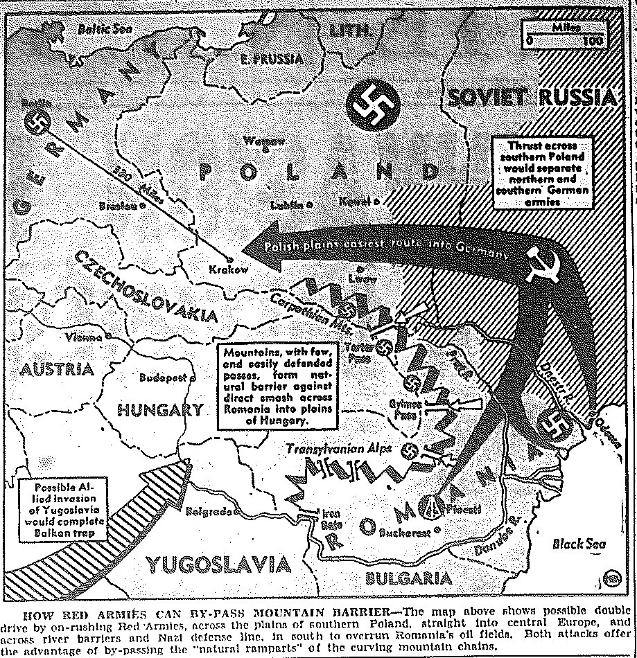
Map of Path of Potential Russian Entry to Eastern Europe, published April 19, 1944
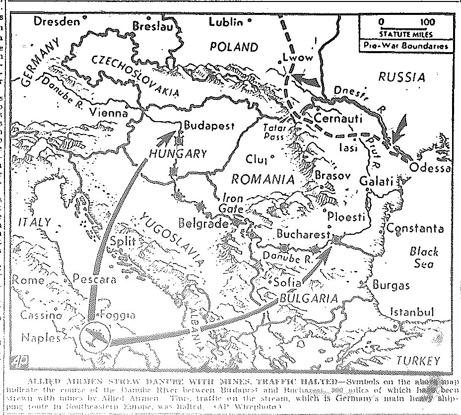
Map of Danube Bombing, published April 21, 1944
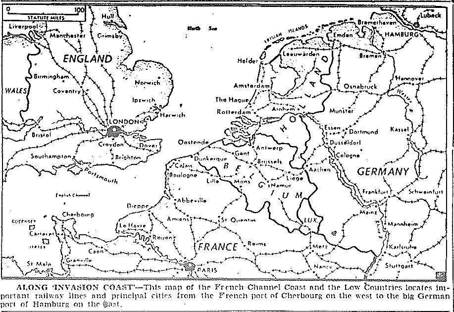
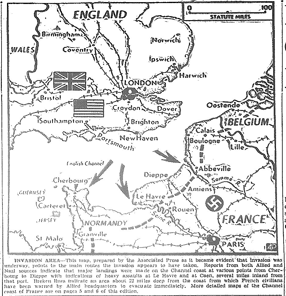
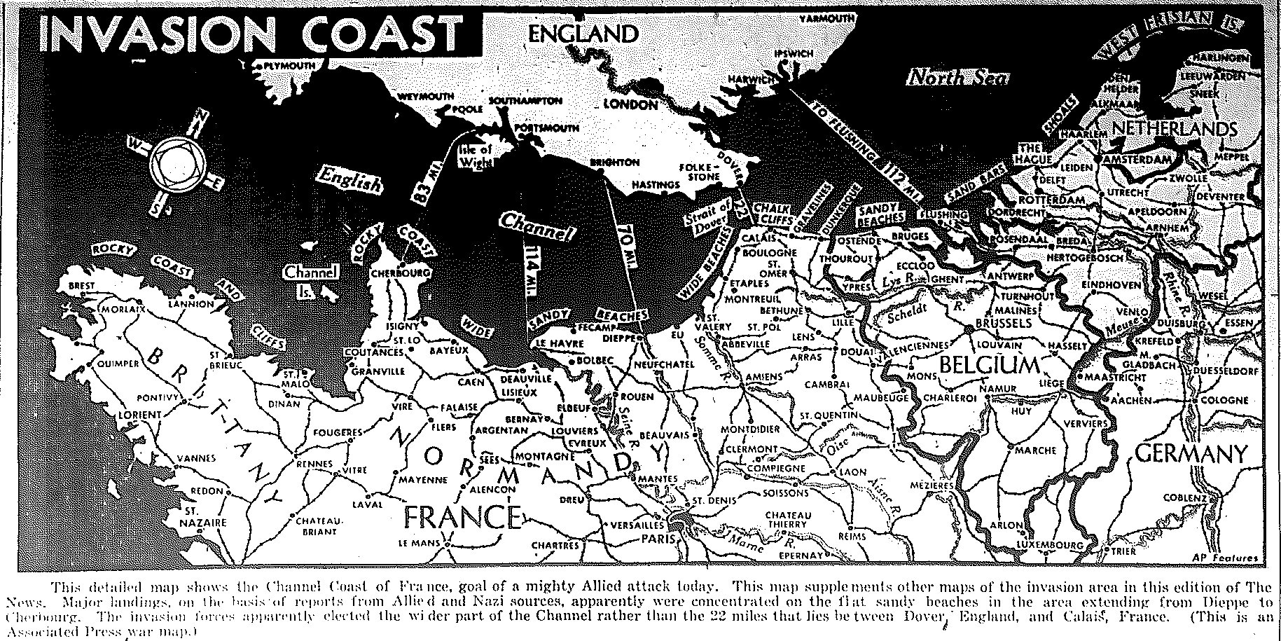
Map of Invasion Coast of France, published May 2, 1944
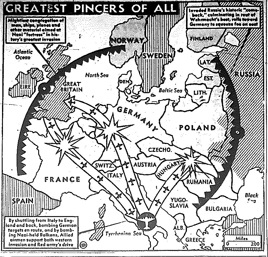
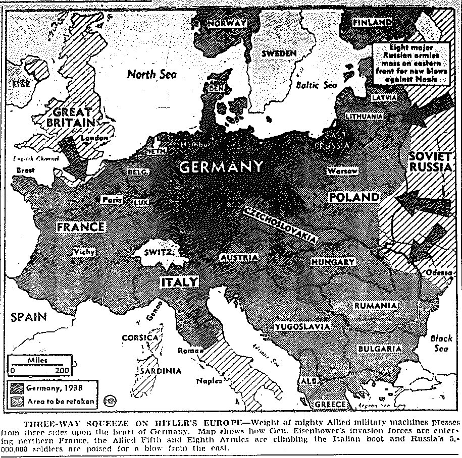
Map of Dual Pincers from East, West, and South on Germany, published May 5, 1944
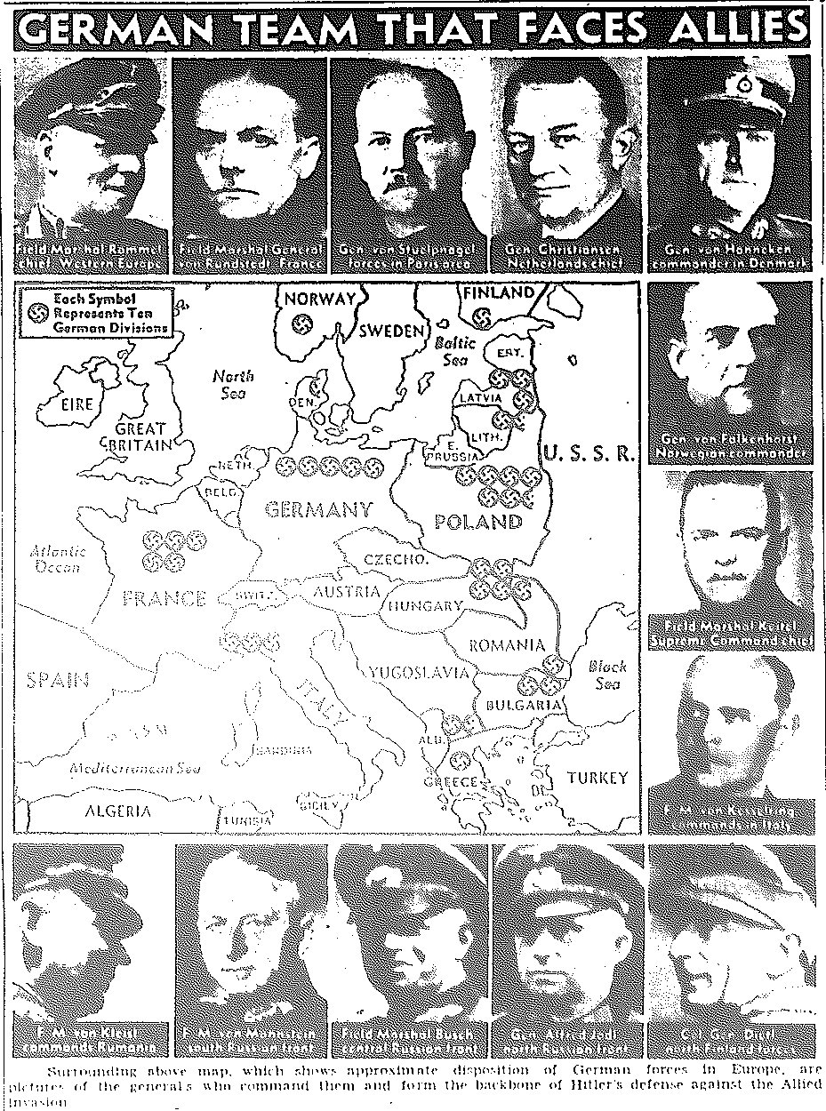
Map of Deployment of German Troops and Commanders, published May 6, 1944
![]()
Maps of June
![]()
|Back to Top| Maps of August| Maps of September-October| Maps of November-December|
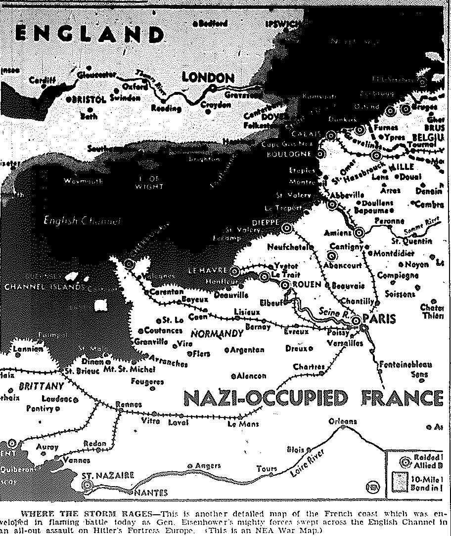
Map of D-Day Invasion of Normandy Coast, published June 6, 1944
Map Two of D-Day Invasion of Normandy Coast, published June 6, 1944
Map Three of D-Day Invasion of Normandy Coast, published June 6, 1944
Map Three of D-Day Invasion of Normandy Coast, alternate caption, published June 6, 1944
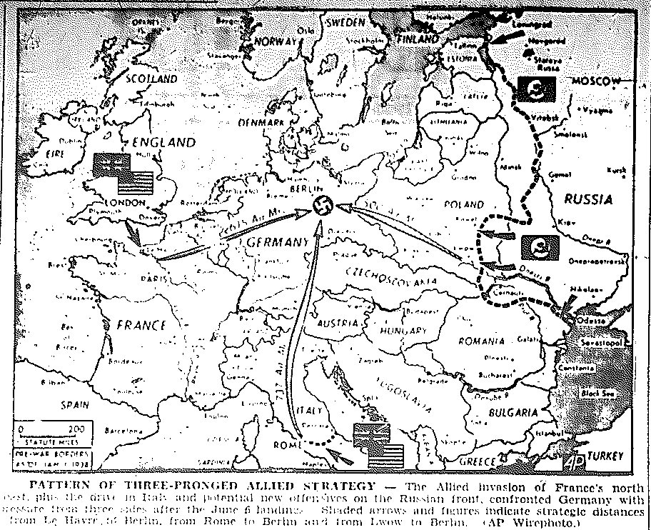
Map of Three-Pronged Approach to Invasion of Germany, from France, Italy, and Russia, published June 7, 1944
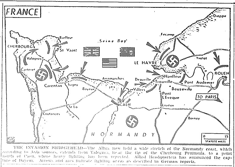
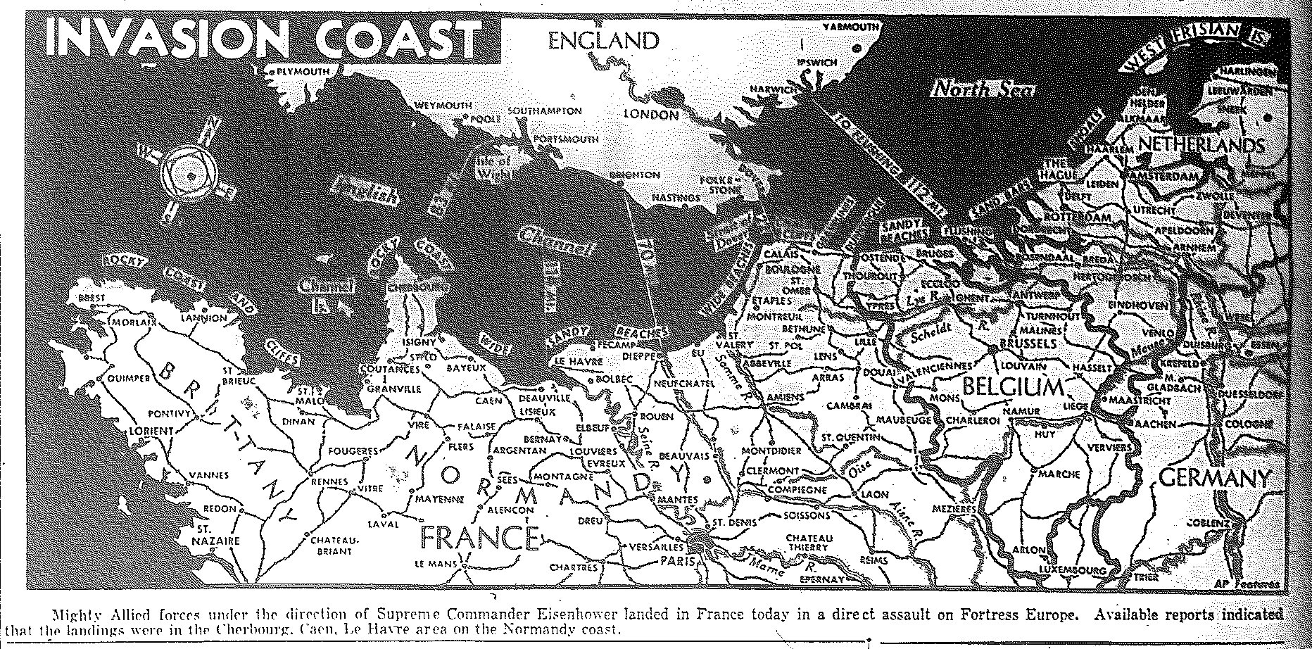
Map of D-Day Invasion of Normandy Coast, published June 8, 1944
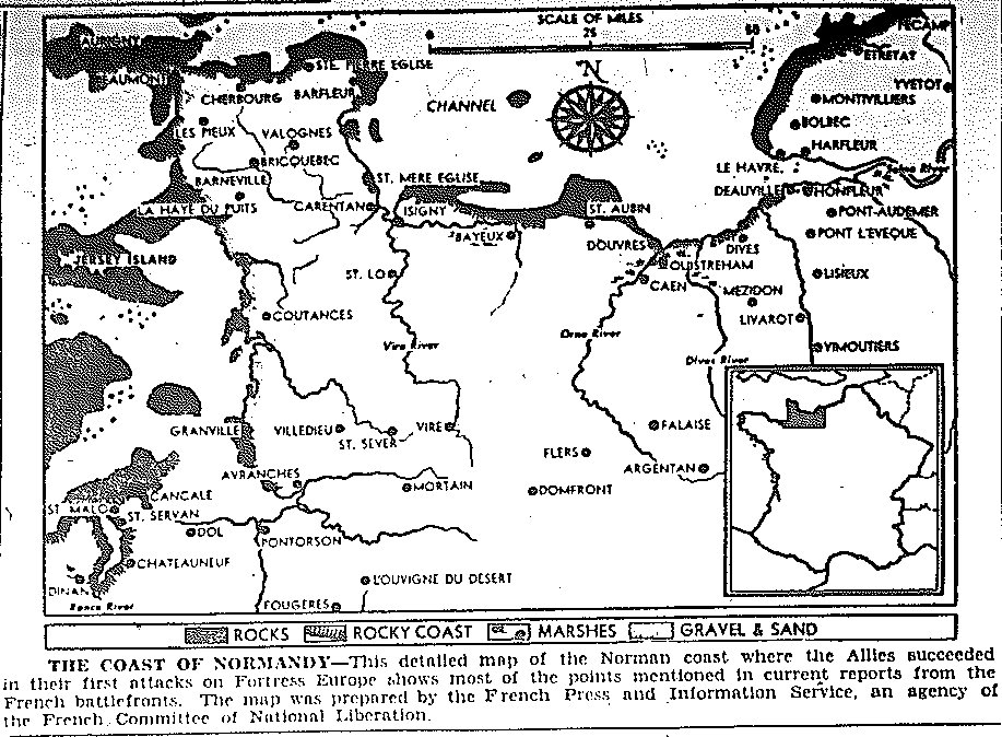
Map of Normandy Coast, published June 9, 1944
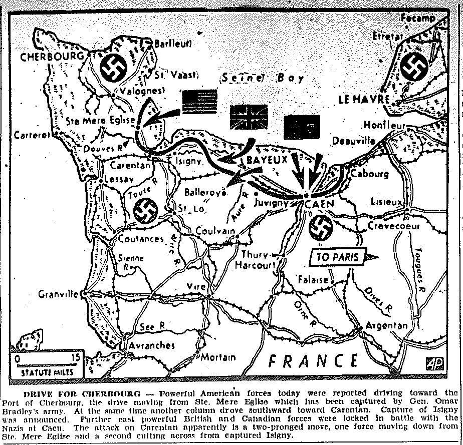
Map of Drive for Cherbourg, published June 10, 1944
Map of Three-Pronged Approach to Invasion of Germany, from France, Italy, and Russia, published June 12, 1944
Map of Drive for Cherbourg, Taking of Montebourg, published June 13, 1944
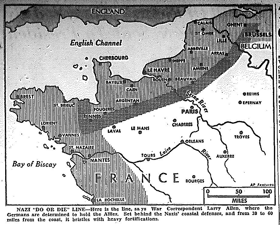
Map of Nazi Hold Line in France, published June 13, 1944
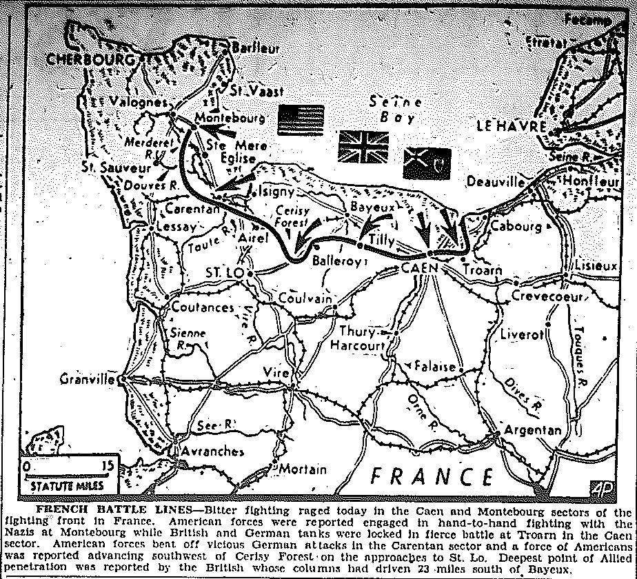
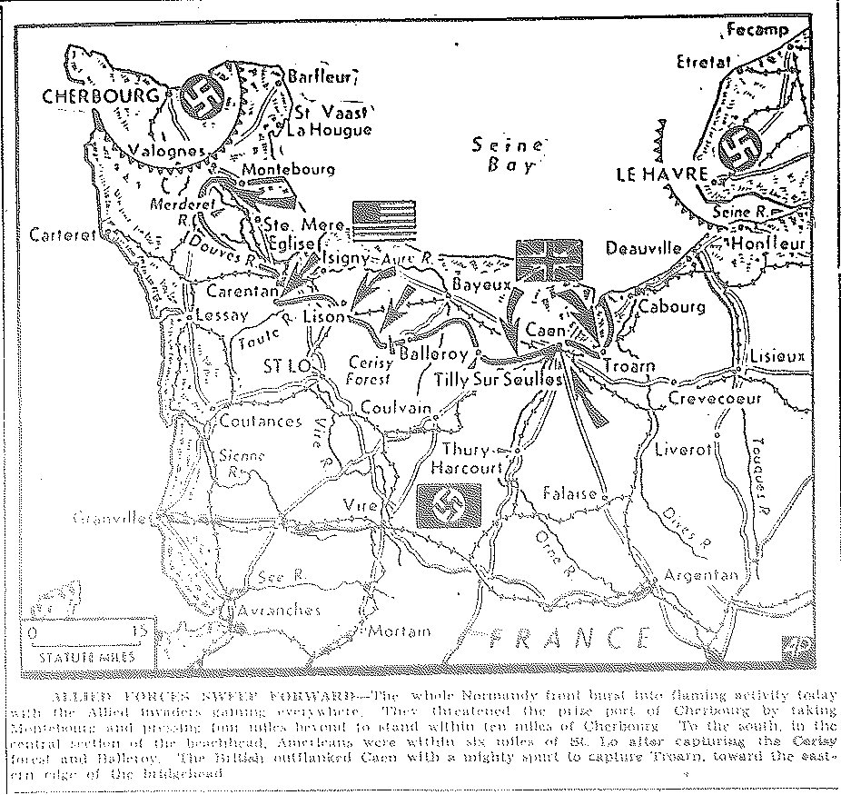
Map of Drive for Cherbourg, Battles for Caen and Montebourg, published June 14, 1944
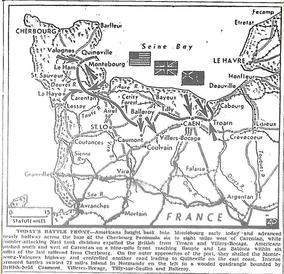
Map of Drive for Cherbourg, published June 15, 1944
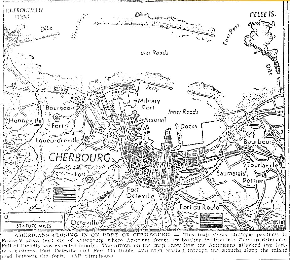
Map of Cherbourg, published June 22, 1944
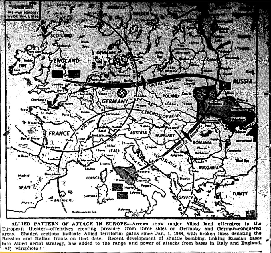
Map of Three-Pronged Approach to Invasion of Germany, from France, Italy, and Russia, published June 26, 1944
![]()
Maps of July
![]()
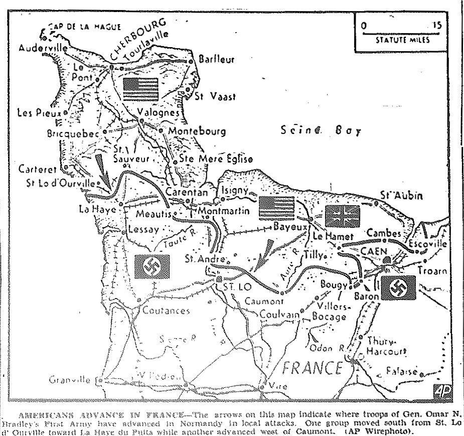
Map of France, General Omar Bradley's First Army Advance, south from St. Lo and west of Caumont, published July 4, 1944
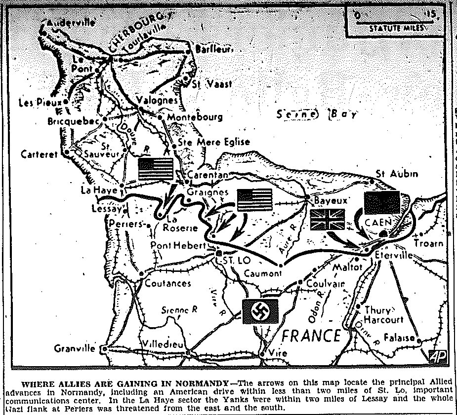
Map of France, General Omar Bradley's First Army Advance, to St. Lo and Lessay, published July 12, 1944
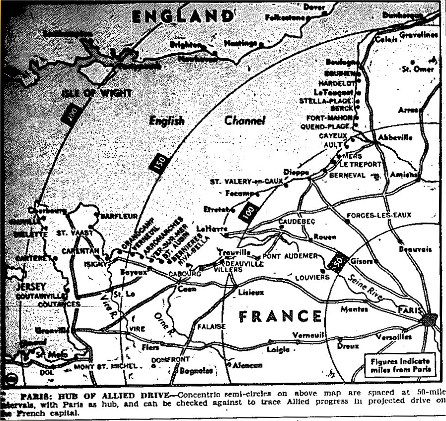
Map of France, Mileage Chart to Paris, published July 26, 1944
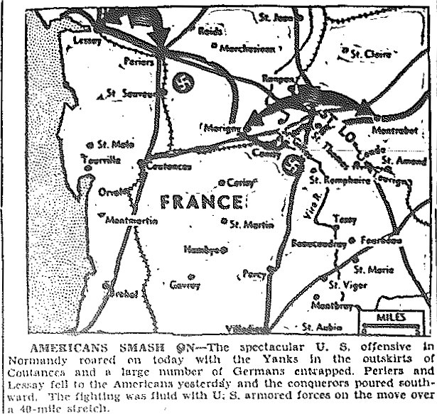
Map of France, General Omar Bradley's First Army Advance,
Fall of Periers and Lessay, Move toward Coutances in Normandy, published July 28, 1944
![]()
Maps of August
![]()
|Back to Top| Maps of June-July, 1944| Maps of September-October| Maps of November-December|
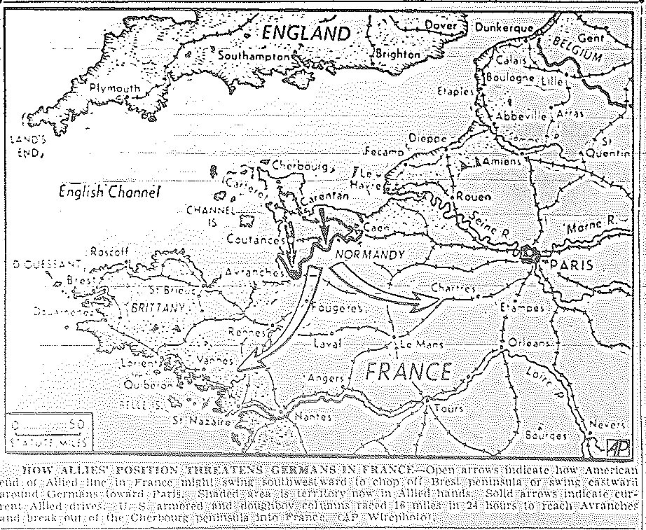
Map of Allied Threats to German Lines, published August 1, 1944
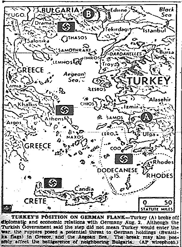
Map of Position of Neutral Turkey, published August 3, 1944
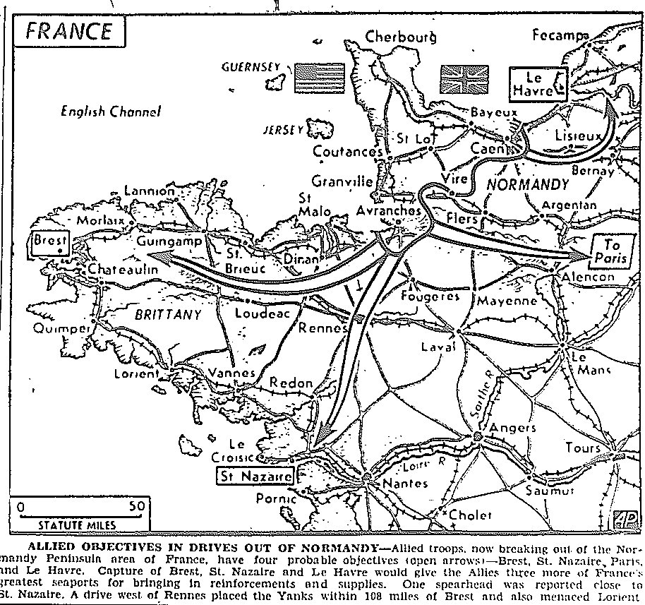
Map of Move Toward Nantes, St. Nazaire, and Brest on Breton Peninsula, and to Le Havre and Paris, published August 4, 1944
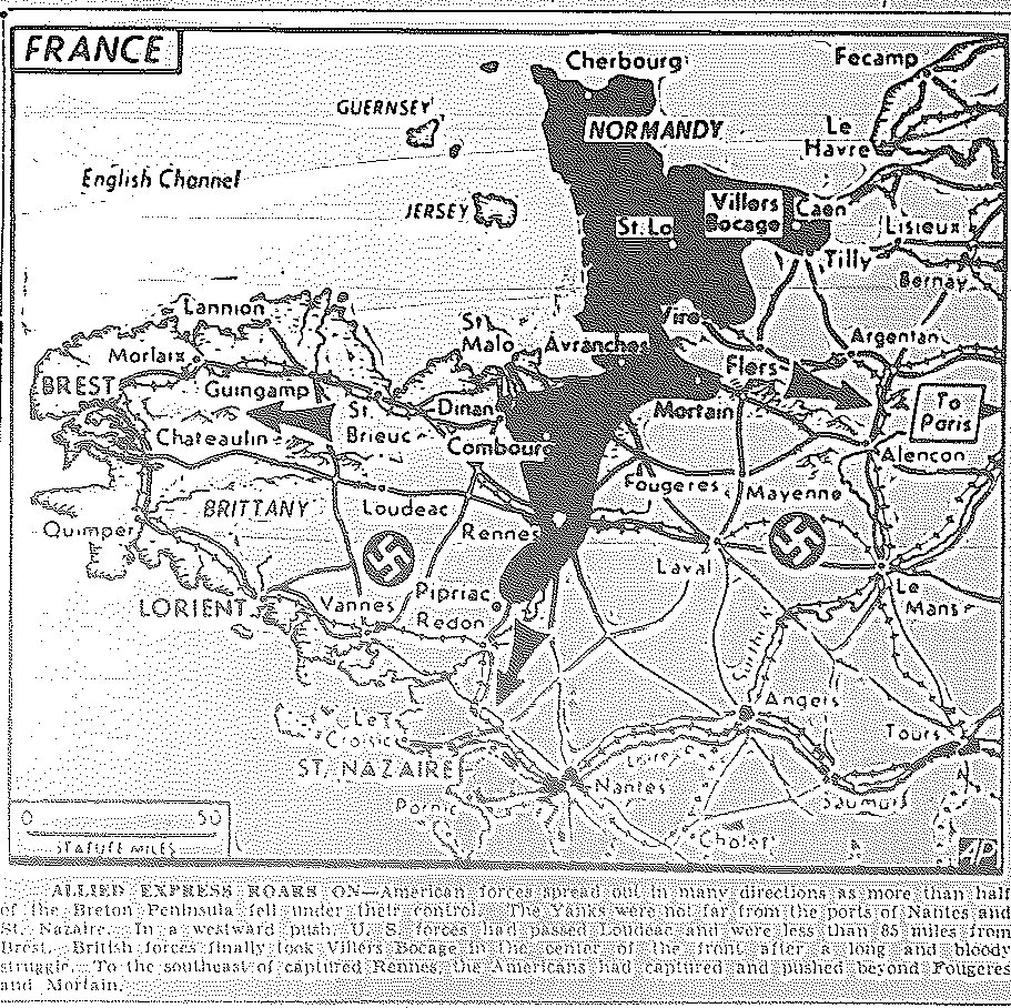
Map of Move Toward Nantes, St. Nazaire, and Brest on Breton Peninsula, Taking of Villers Bocage and Rennes, published August 5, 1944
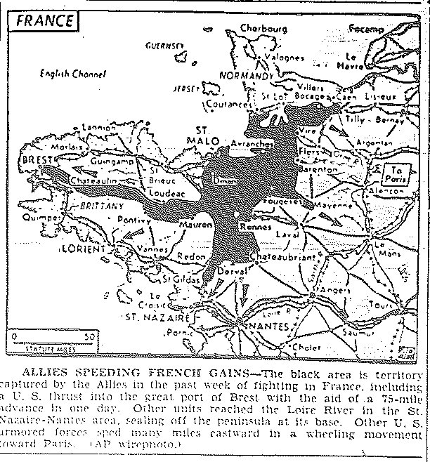
Map of Thrust into Brest and to Loire River, published August 7, 1944
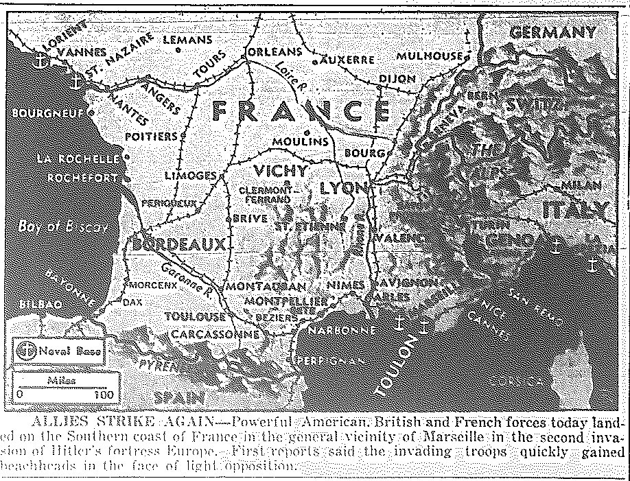
Map of Landing on Marseilles, published August 15, 1944
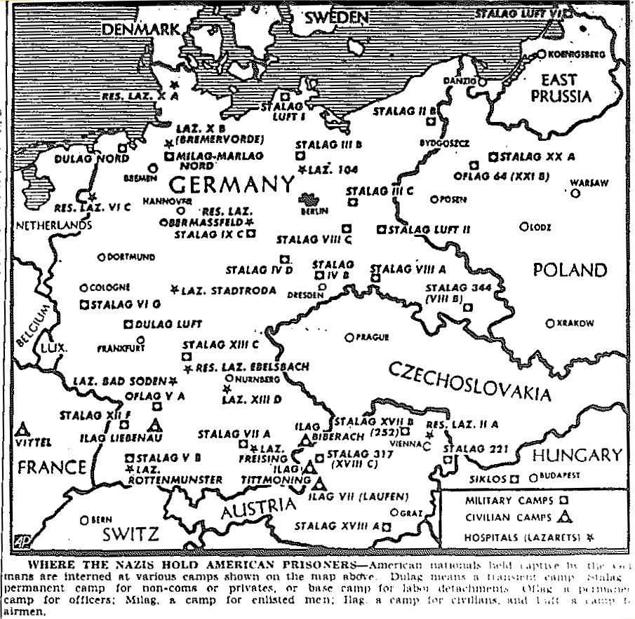
Map of Nazi Prisoner-of-War Camps, published August 16, 1944
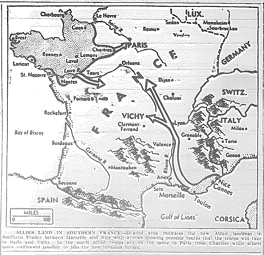
Map of Allied Approaches to Paris and Vichy from Landing Points at Marseilles and Nice, published August 16, 1944
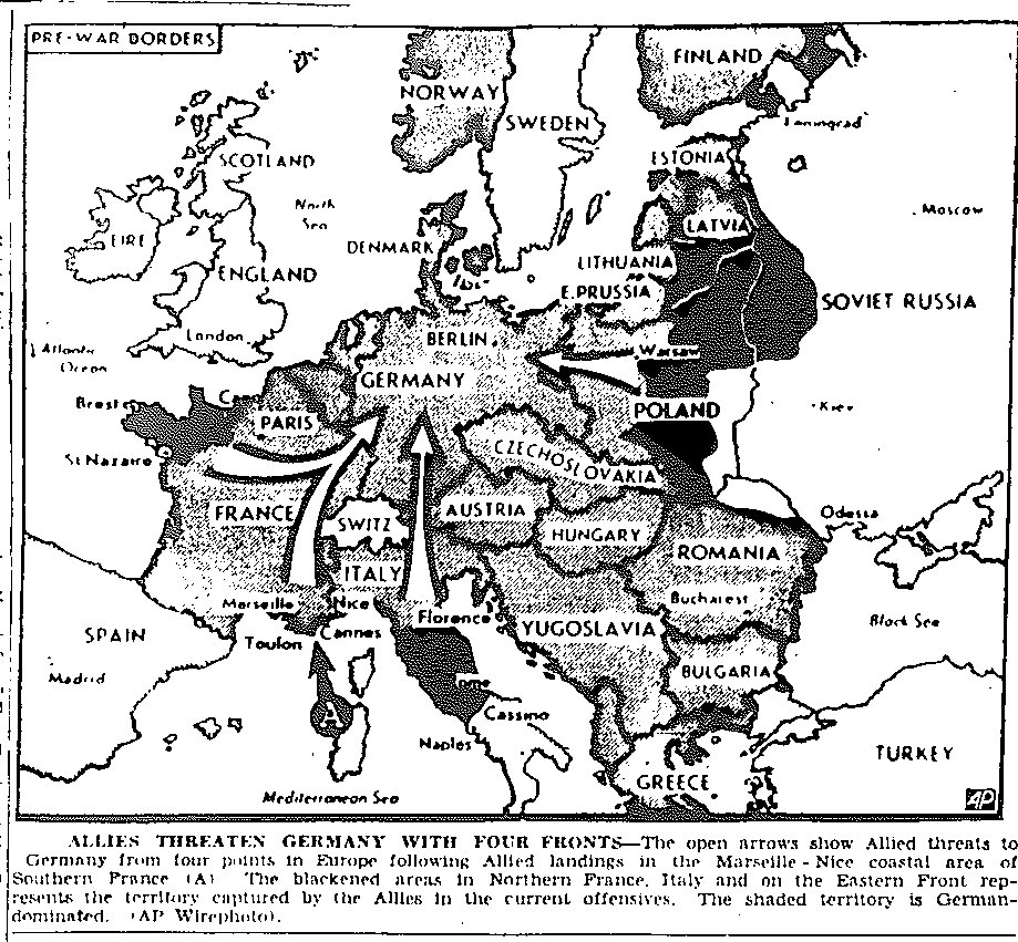
Map of Four-Pronged Approach to Invasion of Germany, from Western and Southern France, Italy, and Russia, published August 17, 1944
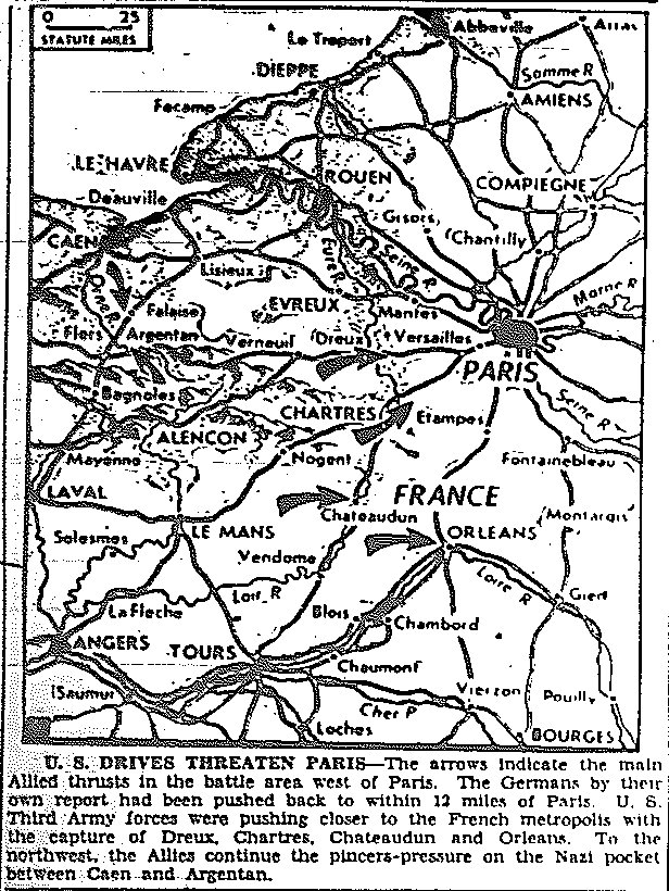
Map of Third Army Drive toward Paris, Taking of Dreux, Chartres, Chateaudun,
and Orleans, Pressure at Caen and Argentan, published August 18, 1944
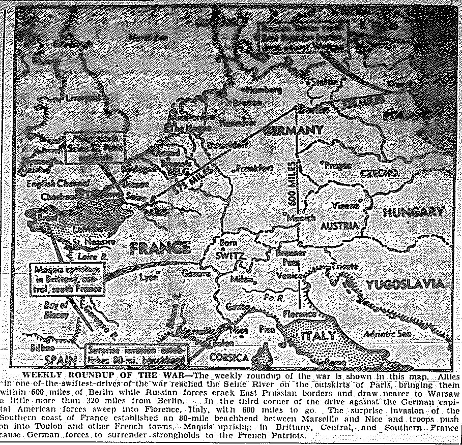
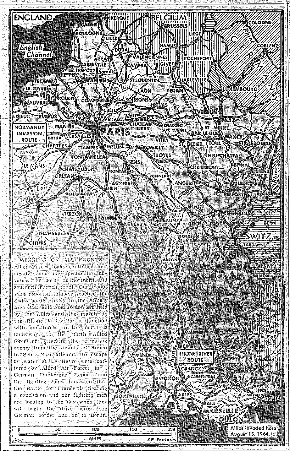
Map of Week's Progress--Third Army Reaches Seine, Southern Forces in France Move into Toulon,
Maquis Uprisings in Brittany, Central and Southern France, Russians Reach East Prussia
and Approach Warsaw, Fifth Army Invades Florence, published August 21, 1944
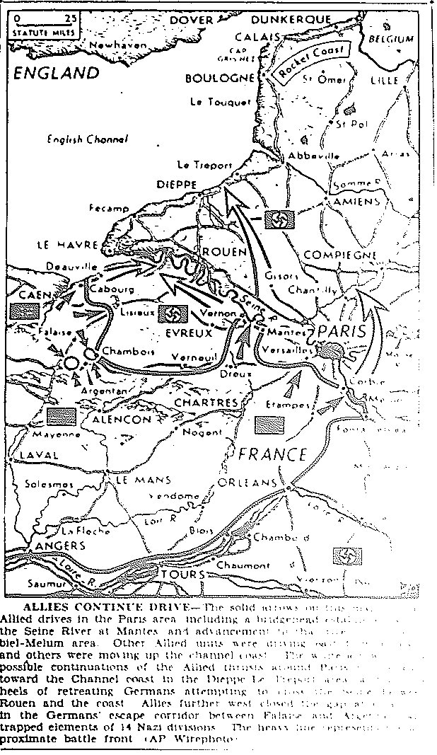
Map of Allied Drives Toward Paris, published August 22, 1944
Map of Allied Drives in France, published August 22, 1944
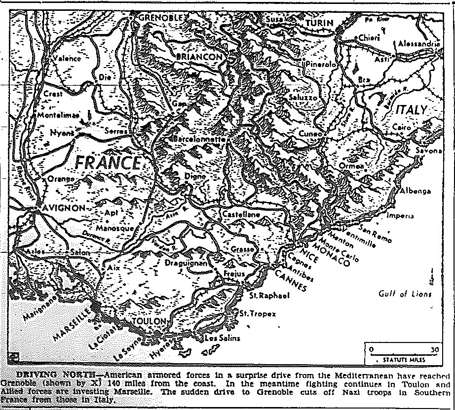
Map of France, Drive to Grenoble by American Forces, Investiture of Marseilles, published August 23, 1944
Map of Allied Drives in France, published August 23, 1944
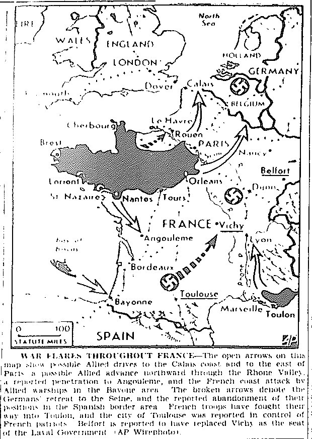
Map of France, Success on All Fronts, published August 24, 1944
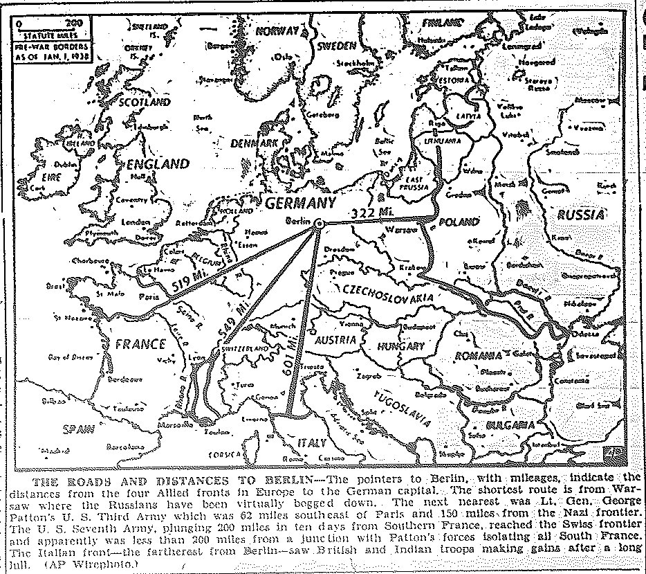
Map of Four Approaches and Mileage to Berlin, published August 25, 1944
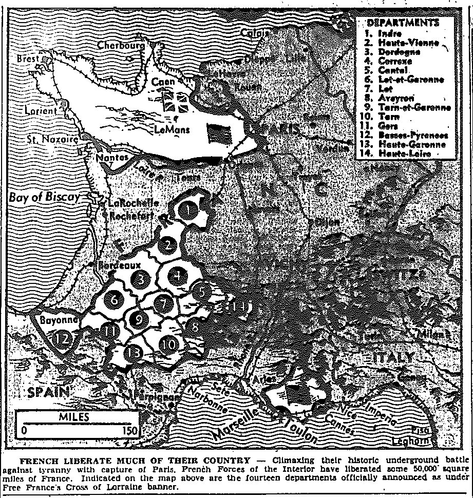
Map of France, Taking of Paris, French Forces Successfully Liberate 50,000 Square Miles with Aid of Underground, published August 25, 1944
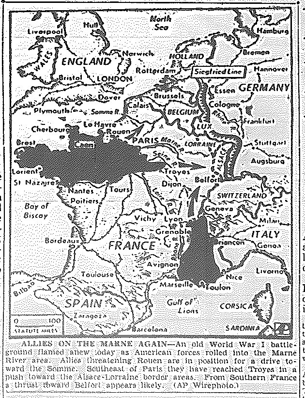
Map of Allied Move into the Marne Area, published August 28, 1944
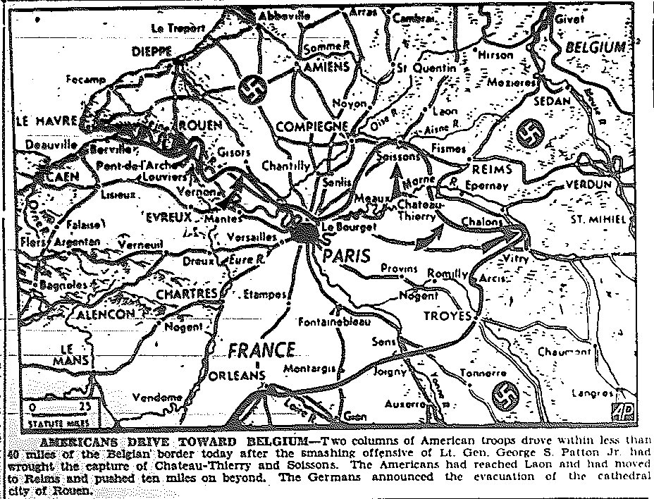
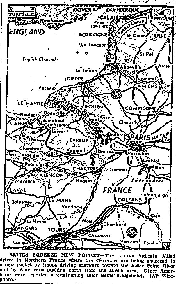
Map of Allied Drive Toward Belgium, Taking by Third Army of Chateau-Thierry
and Soissons, Evacuation of Rouen, Moves Beyond Reims and Laon, published August 30, 1944
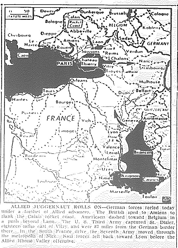
Map of British Drive to Amiens on Calais Rocket Coast, Americans Move Toward Belgium,
Third Army Captures St. Dizier, Seventh Army Moves through Nice, Nazis Fall Back to
Lyon in Allied Rhone Valley Offensive, published August 31, 1944
![]()
Maps of September
![]()
|Back to Top| Maps of June-July, 1944| Maps of August| Maps of November-December|
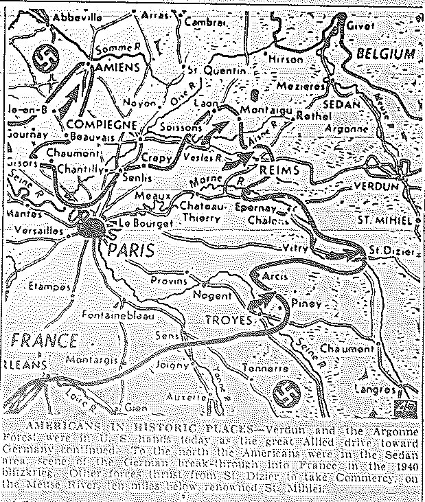
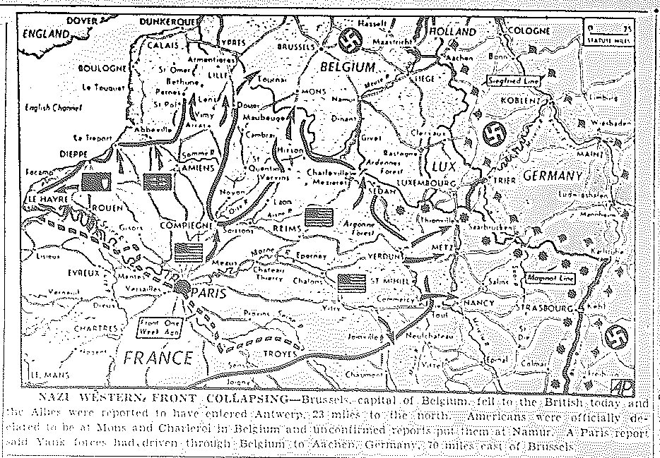
Map of Taking of Verdun and Argonne Forest, Americans in Sedan and Commercy, published September 1, 1944
Map of Taking of Verdun, St. Mihiel, and Commercy by Third Army, published September 2, 1944
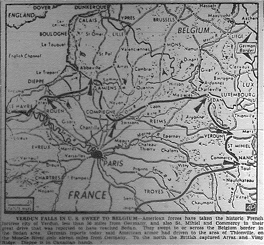
Map of Taking of Brussels by British as Allies Entered Antwerp, Americans at Mons
and Charleroi, and Reported at Aachen, Germany, published September 4, 1944
Map of Allied Controlled Territory, published September 4, 1944
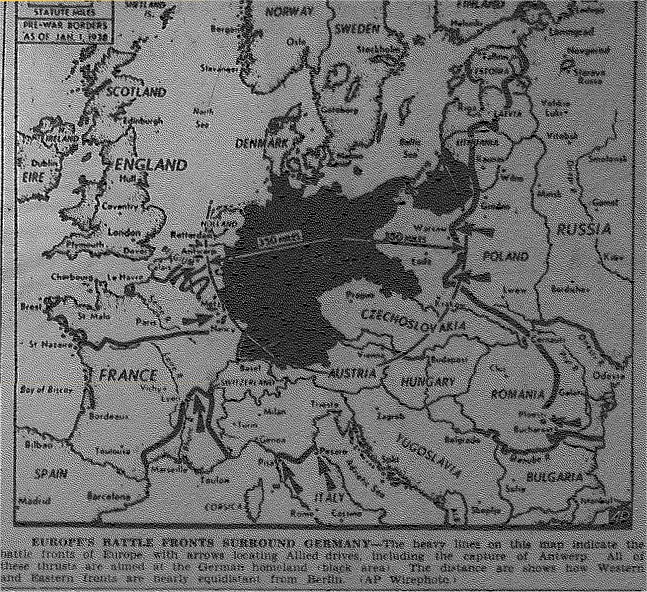
Map of War Fronts Encompassing Germany, published September 5, 1944
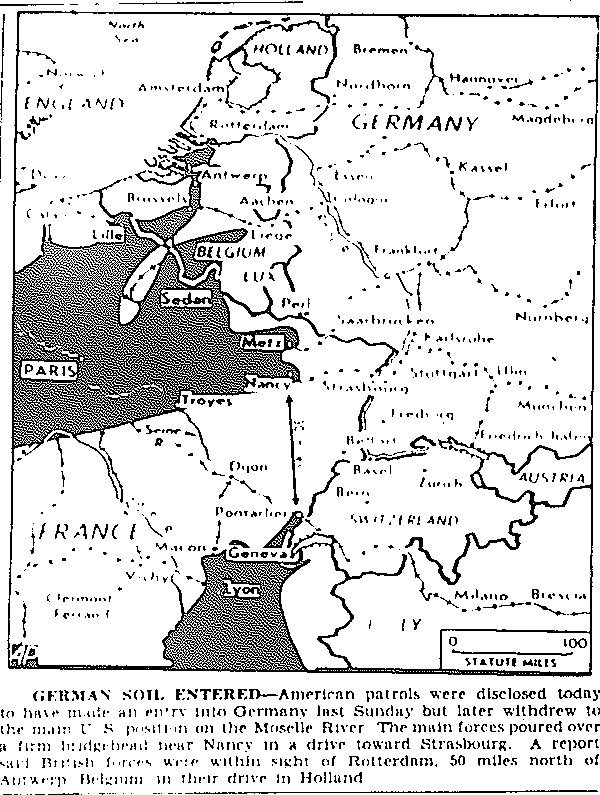
Map of Central European Front, Third Army Patrols Enter Germany, published September 6, 1944
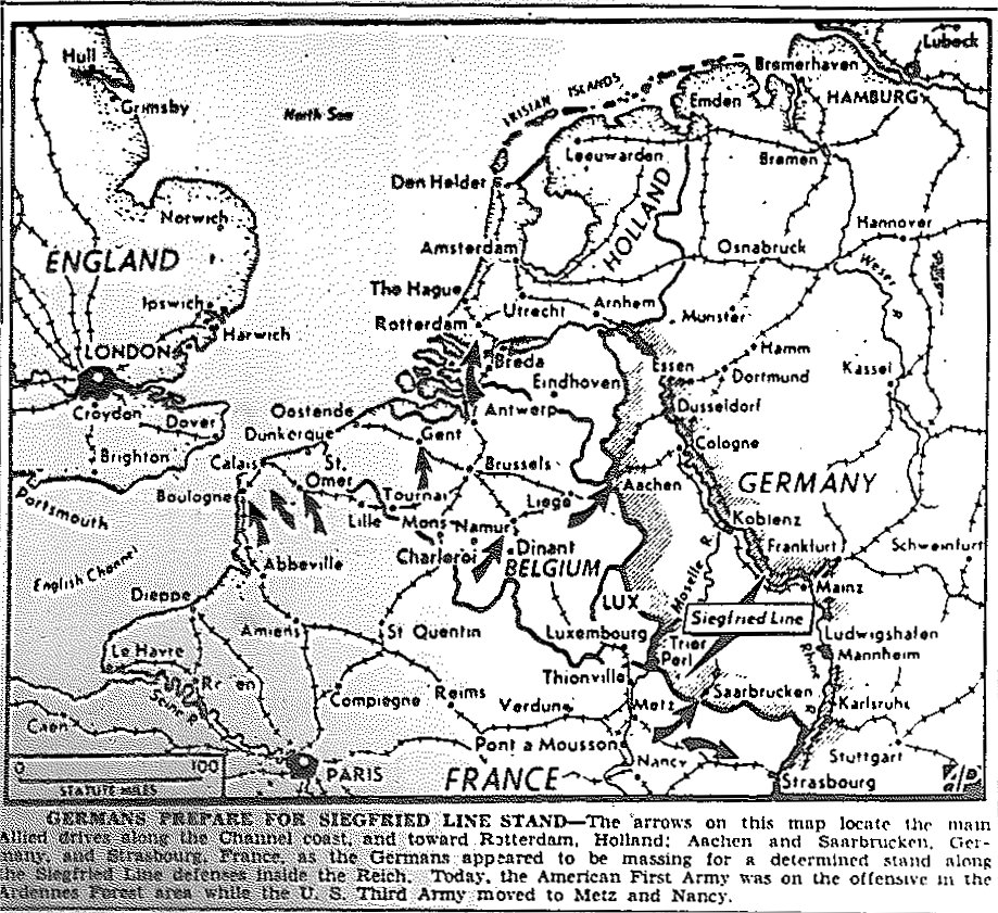
Map of German Stand at Siegfried Line, Third Army Moves to Metz and Nancy,
First Army on Offensive in Ardennes, published September 7, 1944
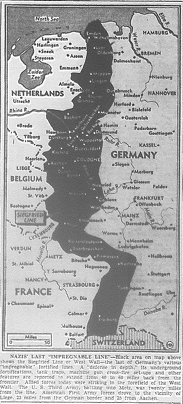
Map of Siegfried Line, published September 8, 1944
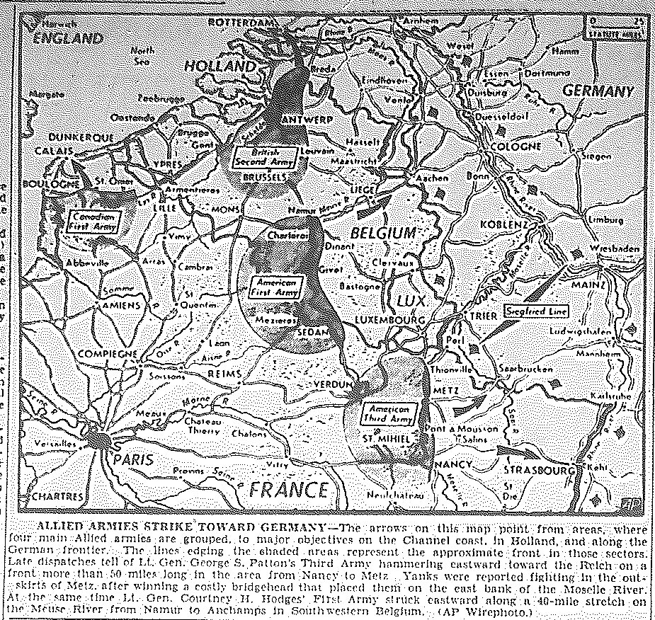
Map of Third Army Reaching East Bank of Moselle River, First Army Strikes
Along Meuse River from Namur to Anchamps in Belgium, published September 8, 1944
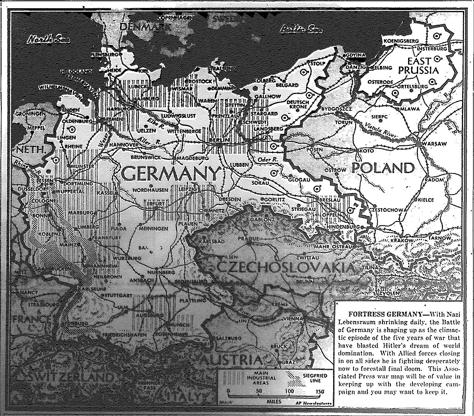
Map of Shrinking Nazi Empire, published September 9, 1944
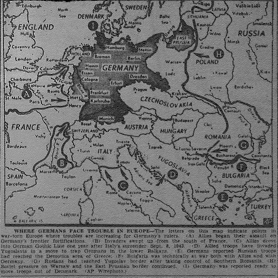
Map of Three-Pronged Approach to Invasion of Germany, from France, Italy, and Russia, published September 9, 1944
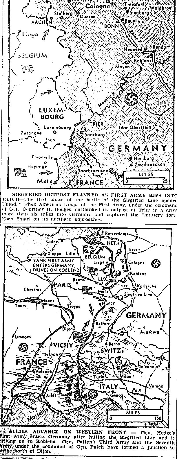
Maps of First Penetration of Siegfried Line at Trier; Third Army Joins with Seventh Army, Moving Toward Belfort, published September 13, 1944
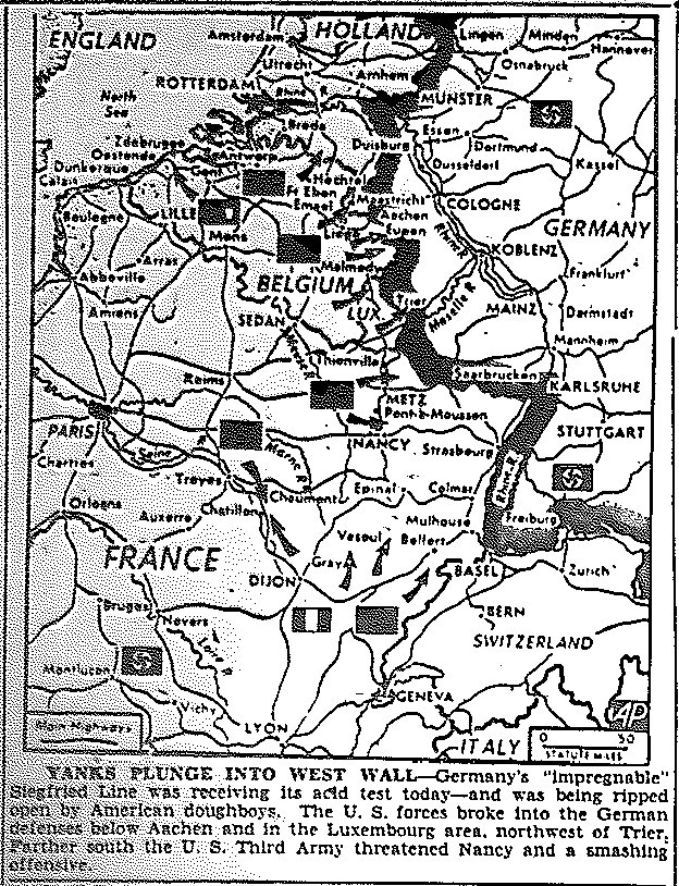
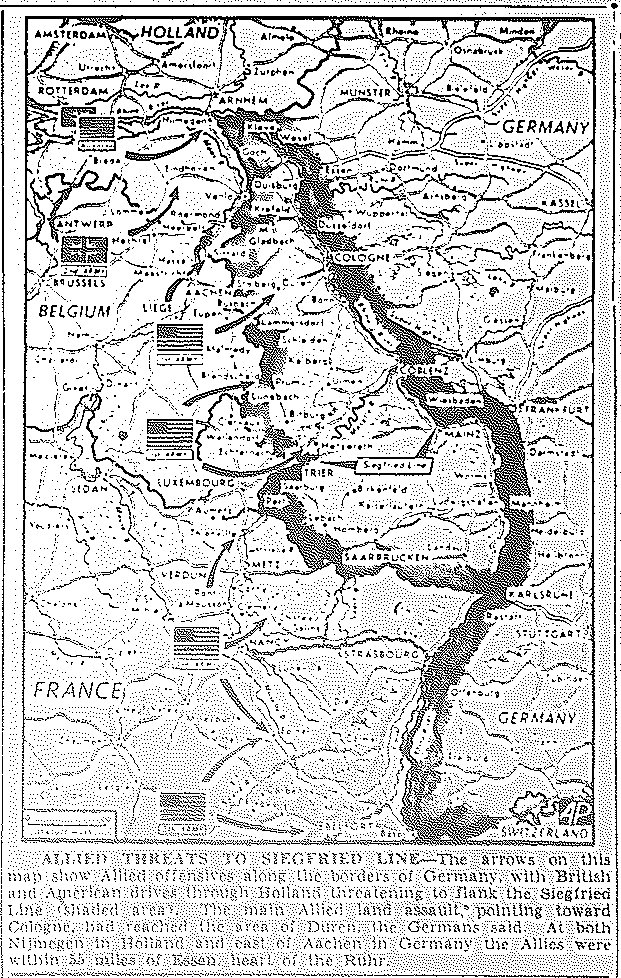
Map of Allied Smash against Siegfried Line, published September 14, 1944
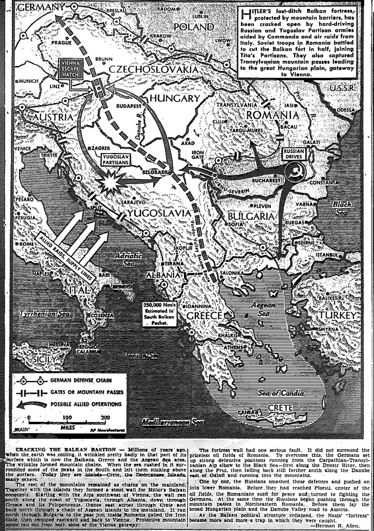
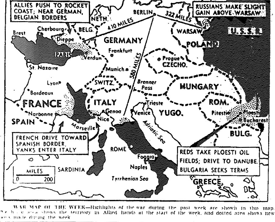
Map of Allied Thrust into Balkans to Trap 50,000 Germans, published September 15, 1944
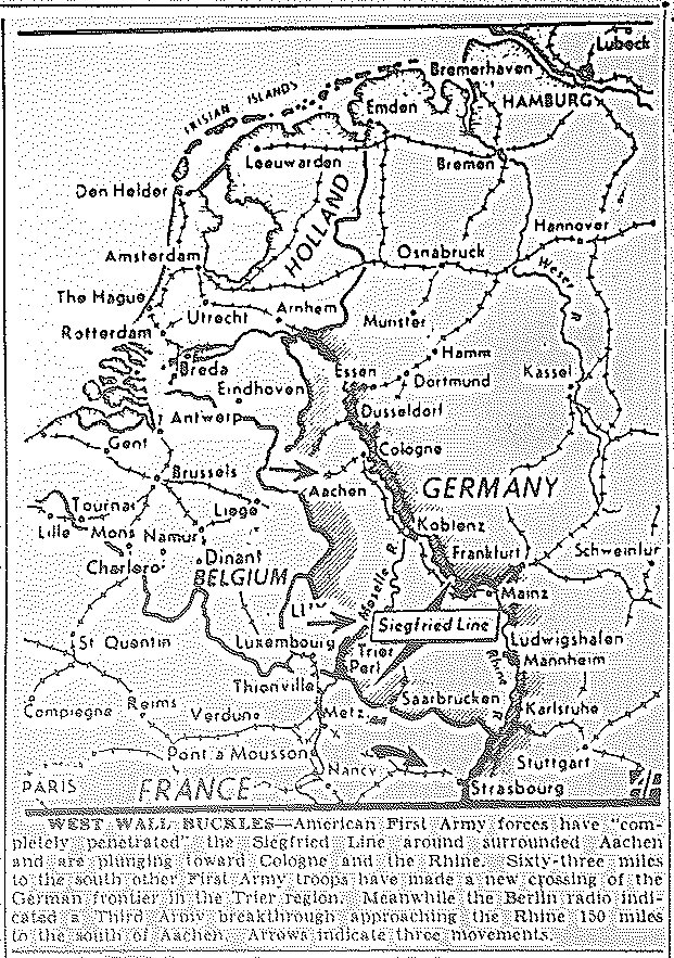
Map of First Army Penetration of Siegfried Line at Aachen, Moving toward Cologne,
and in Trier Sector, Third Army Moves toward Strasbourg, published September 16, 1944
Map of Seventh Army Entering Belfort, Third Army Moving Past Metz and Nancy,
First Army Moving Toward Cologne, published September 18, 1944
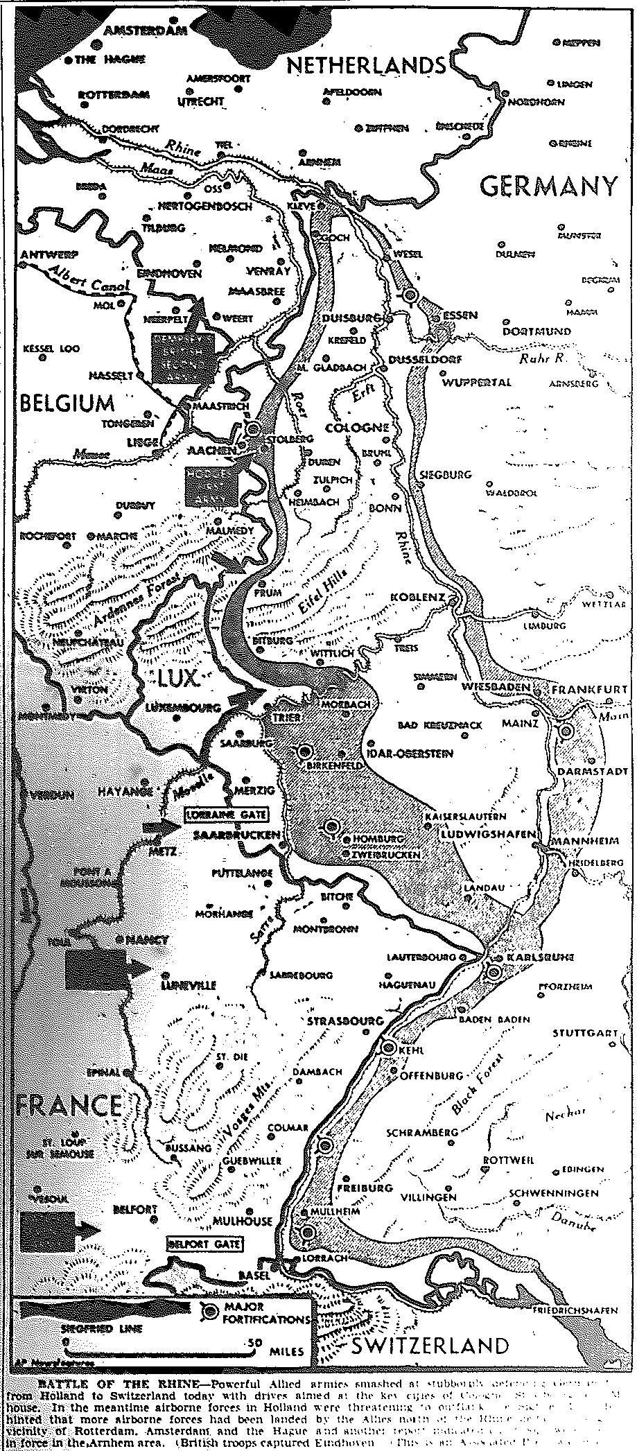
Map of Battle of the Rhine, published September 19, 1944
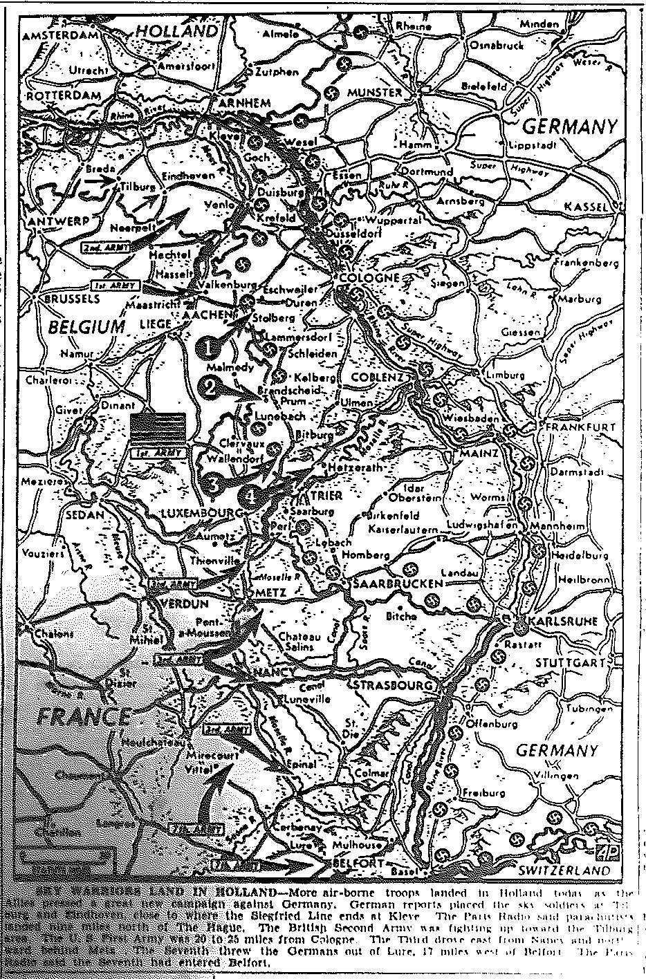
Map of Move to Flank Siegfried Line through Holland,
Moves Toward Cologne and Essen, published September 20, 1944
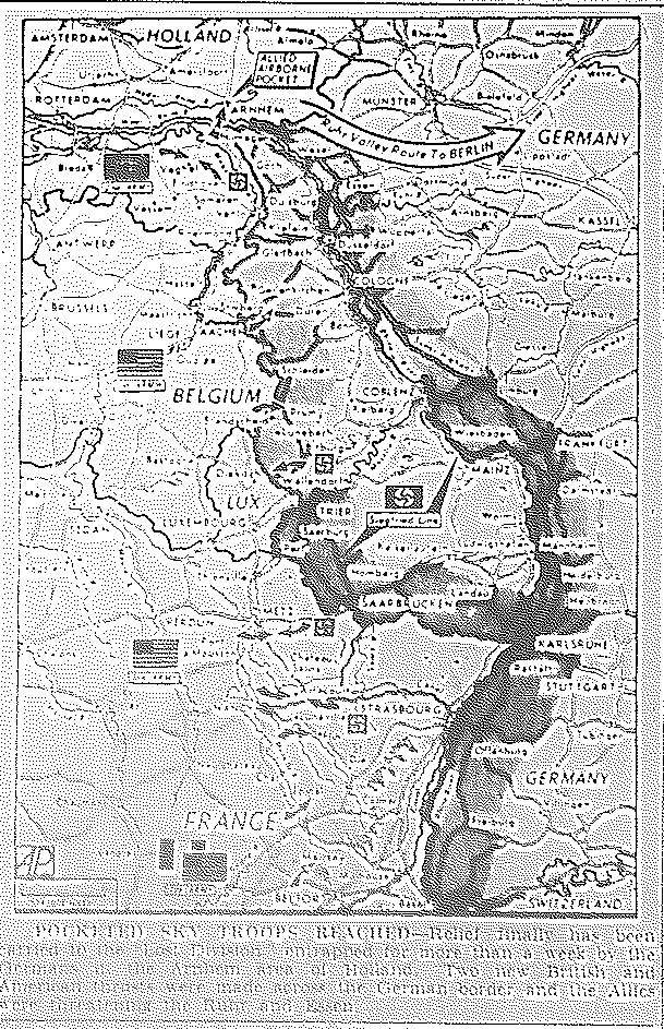
Map of Relief to Airborne Troops, published September 25, 1944
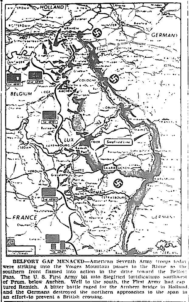
Map of Seventh Army Strike into Vosges Mountain Passes to the Rhine, First Army Menaces
Siegfried Line near Prum, First Army Captures Remich, published September 30, 1944
![]()
Maps of October
![]()
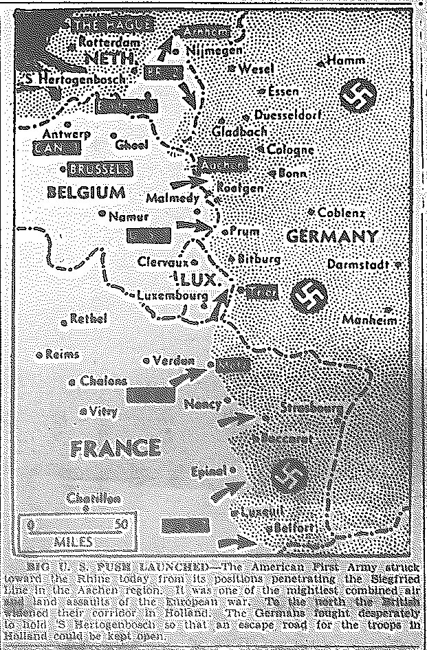
Map of American First Army Drive to the Rhine at Aachen; British Widening
Corridor in Holland, against 'S Hertogenbosch, published October 2, 1944
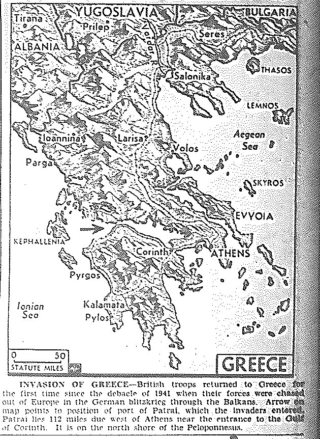
Map of British Invasion of Greece at Patrai, published October 5, 1944
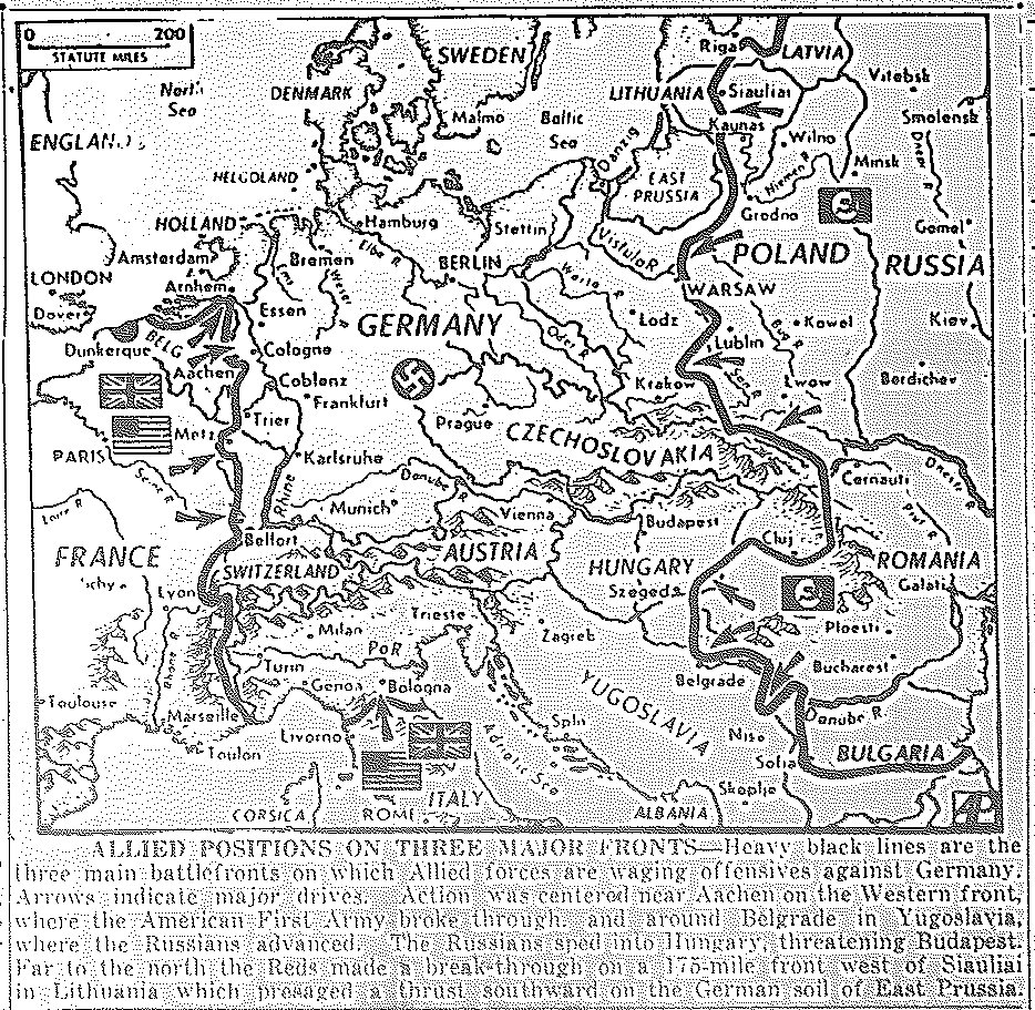
Map of Three-Pronged Approach to Germany: Americans at Aachen;
Russian Advances to Belgrade and Budapest; and Russian Advances in Lithuania, published October 9, 1944
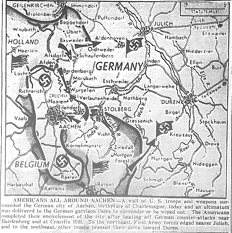
Map of First Army Encirclement of Aachen, published October 10, 1944
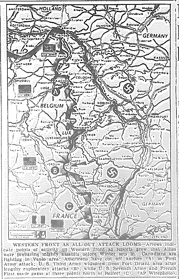
Map of First Army Attack on Aachen; Third Army Withdrawal from Driant;
Seventh Army and French First Army Gains North of Belfort, published October 18, 1944
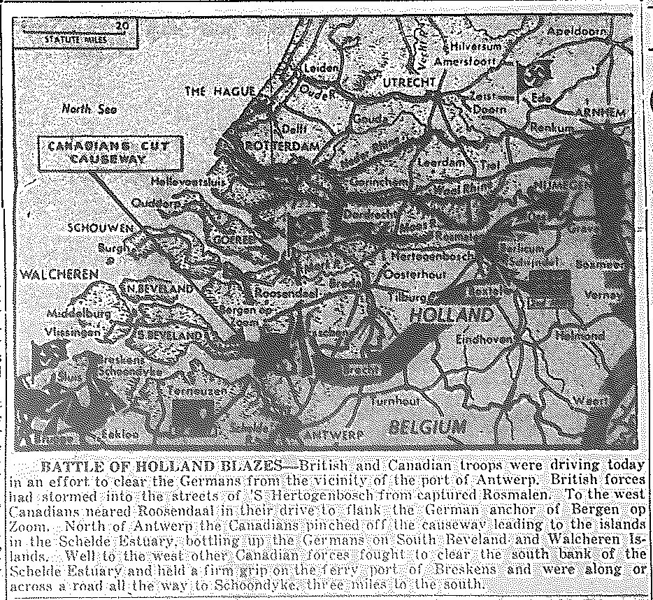
Map of British and Canadian Drives in Holland, at Antwerp, 'S Hertogenbosch, and Roosendaal, published October 24, 1944
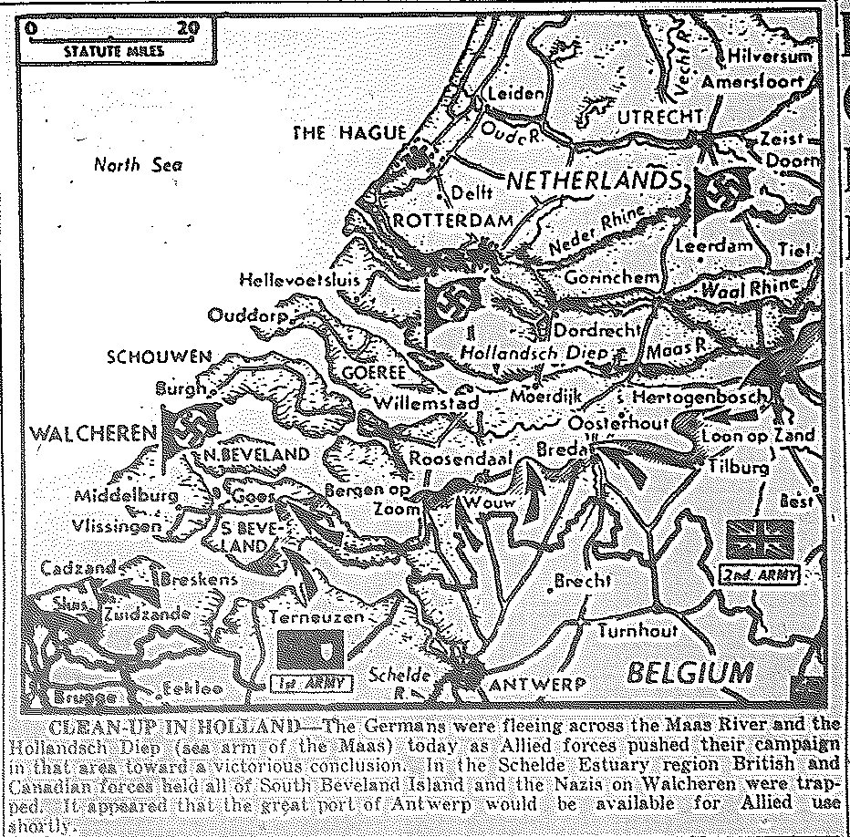
Map of Clean-up of Holland by British and Canadians, Fall of Antwerp Imminent, published October 31, 1944
![]()
Maps of November
![]()
|Back to Top| Maps of June-July, 1944| Maps of August| Maps of September-October|
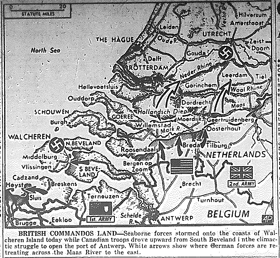
Map of Landing on Walcherin Island, Drive of British and Canadians to Take Antwerp,
Fleeing of Germans Across Maas River, published November 1, 1944
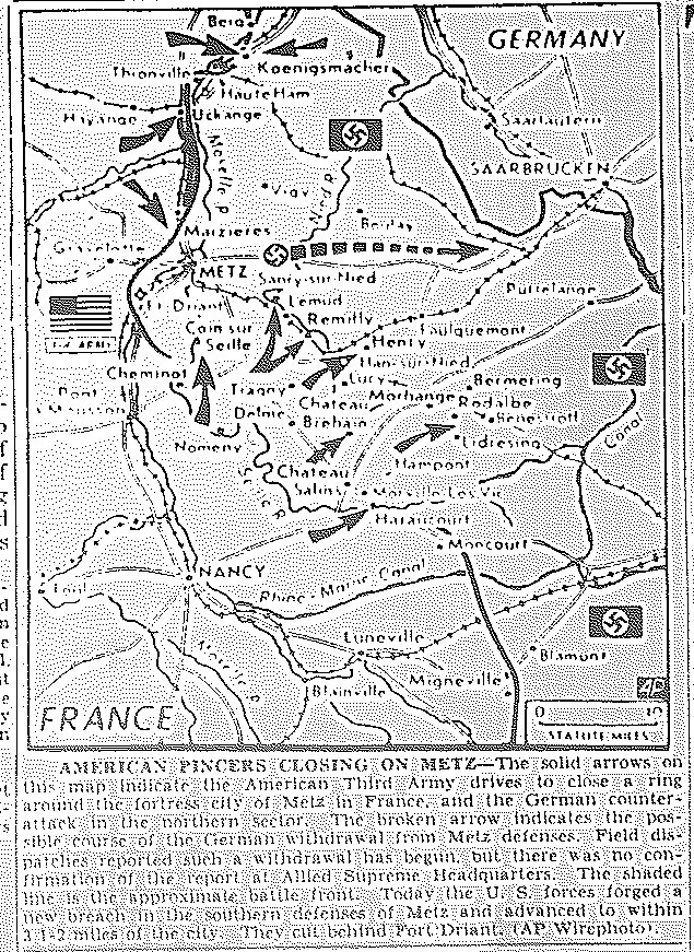
Map of Third Army Drive to Encircle Metz, published November 14, 1944
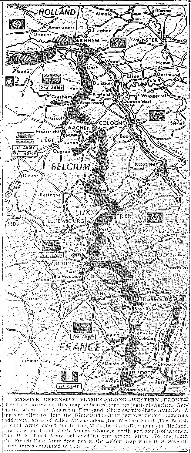
Map of First and Ninth Armies Drive East of Aachen into Rhineland,
British Second Army Approach to Roermund, Holland, published November 17, 1944
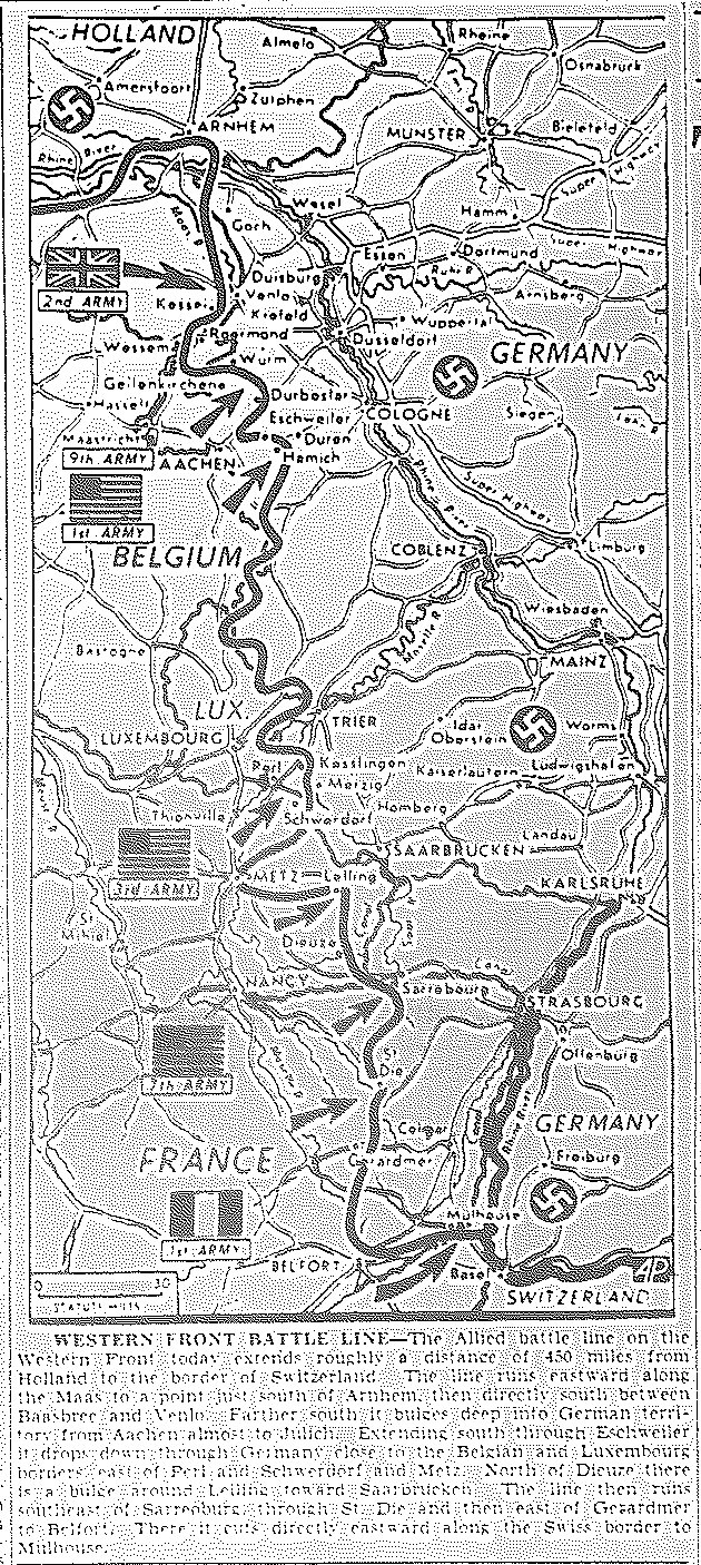
Map of 450-mile Western Front, from Holland to Switzerland, published November 22, 1944
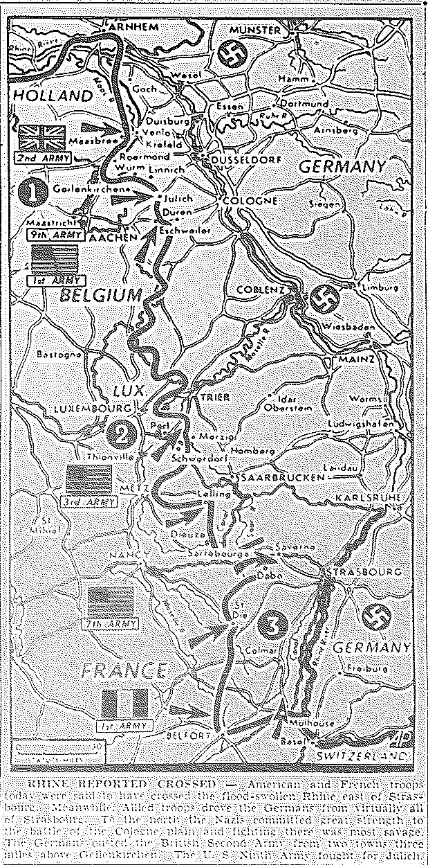
Map of Crossing of Rhine East of Strasbourg,
Driving of Germans from Strasbourg, published November 24, 1944
Map of Western Front
British 2nd Army Clear Grubbenvorst Pocket; U.S. 9th Army at Kirchberg, Germany;
U.S. 1st Army at Inden; U.S. 3rd Army Approaching Saarbrucken and Saarlautern;
U.S. 7th Army Pursuing Germans North of Saarebourg, French Cross Rhine North of
Strasbourg; French 1st Army Progress at Belfort Gap, published November 28, 1944
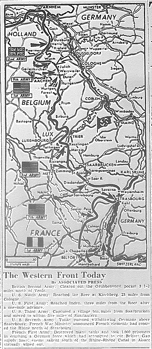
Map of Western Front, published November 30, 1944
![]()
Maps of December
![]()
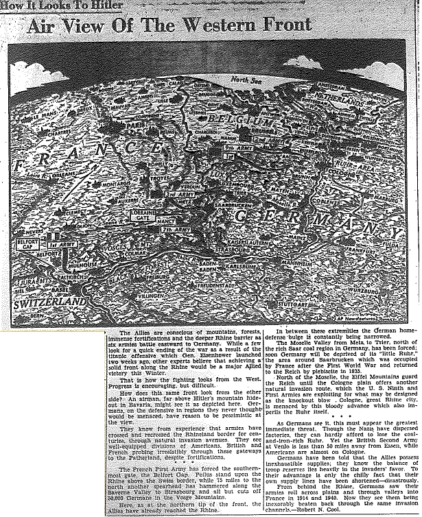
Map of Air View of Western Front, published December 1, 1944
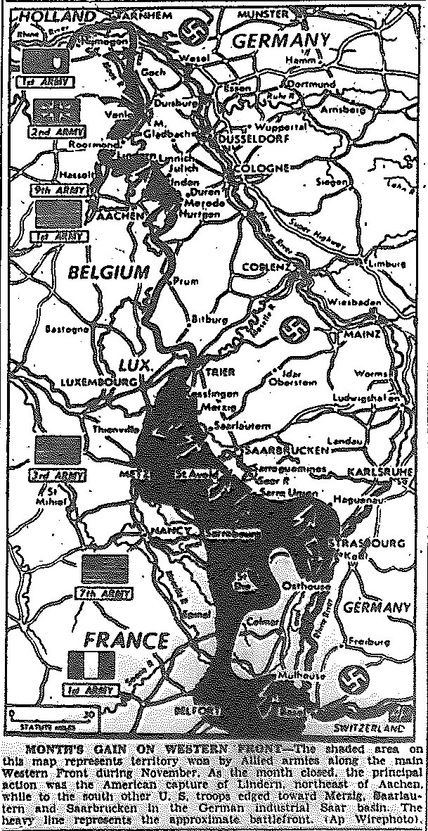
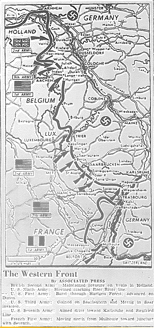
Map of Gains During November on Western Front, published December 2, 1944
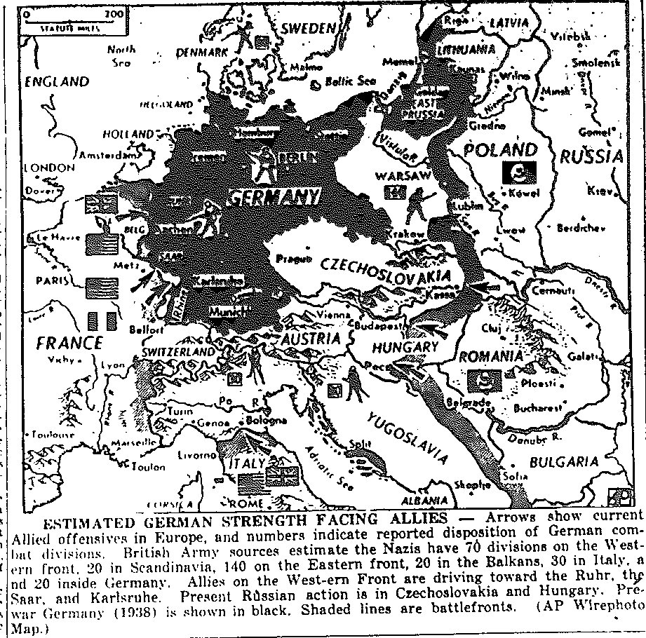
Map of Estimated German Divisions Deployed in Europe, published December 4, 1944
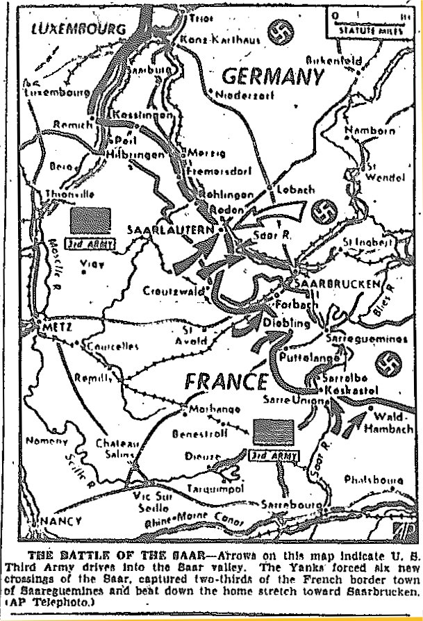
Map of Third Army Drive into Saar, published December 6, 1944
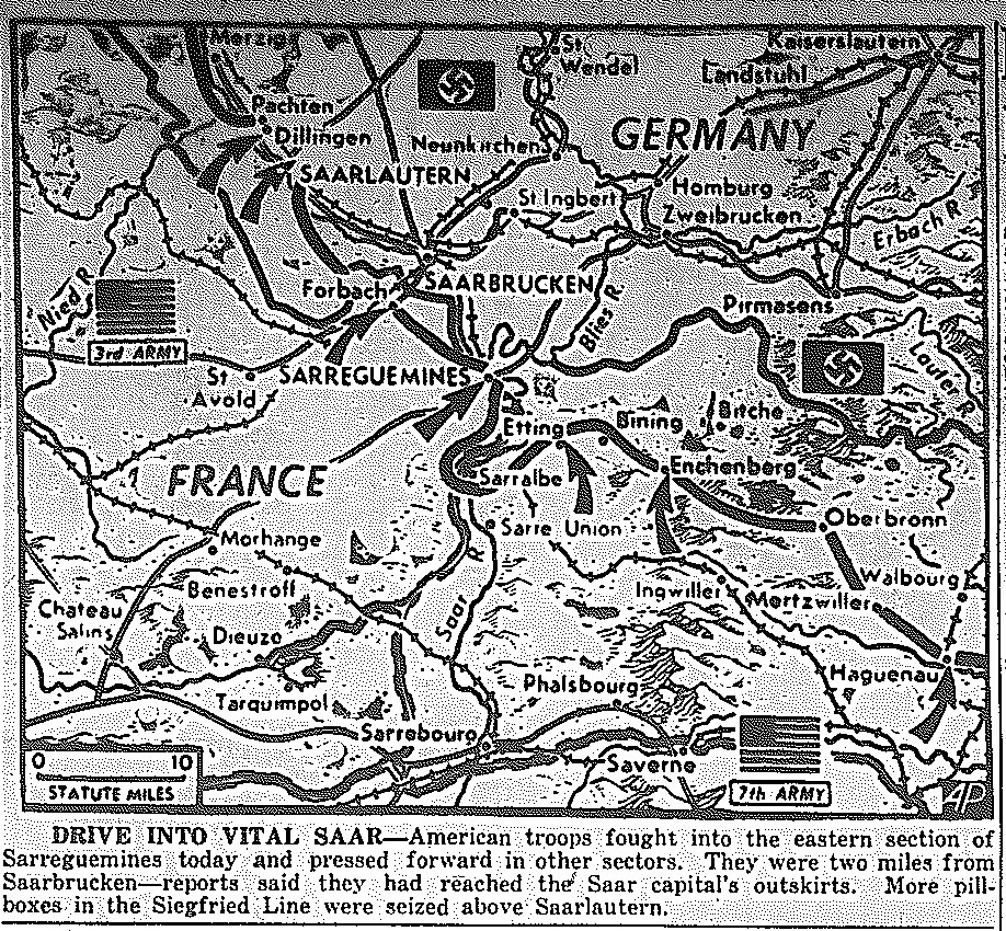
Map of Third Army Drive into Saar, published December 9, 1944
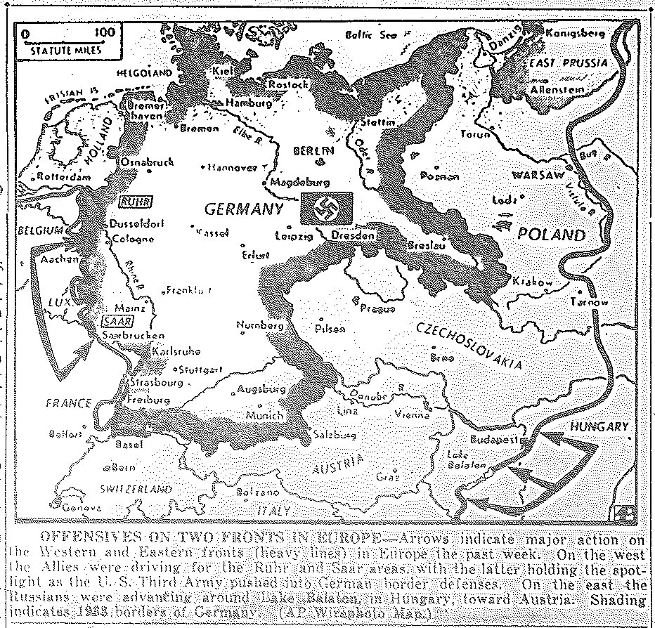
Map of Drives on Ruhr and Saar in West, Russian Drive through Hungary to Austria, published December 11, 1944
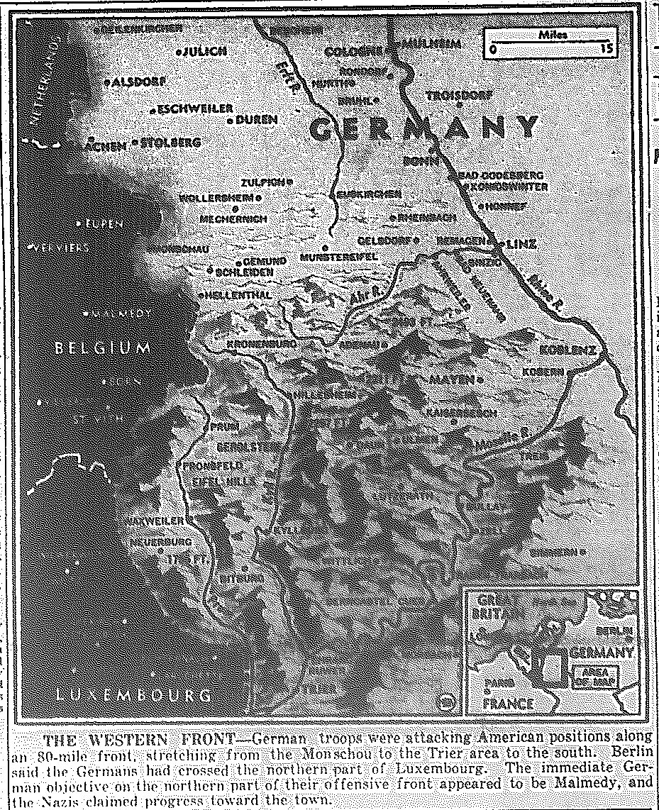
Map of Battle of the Bulge: German Counter-Offensive Along 80-mile Front from Monschou to the Trier Area, published December 18, 1944
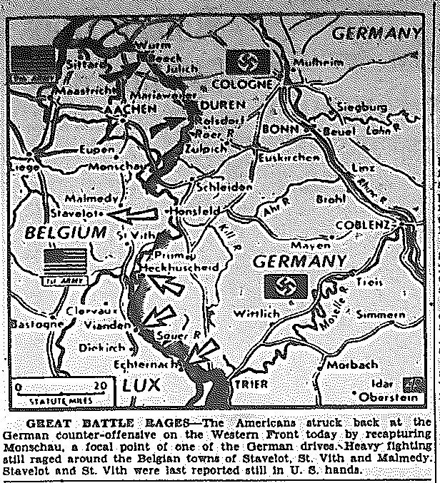
Map of Battle of the Bulge: Allied Capture of Monschau, as Americans Resist
German Counter-Offensive, published December 20, 1944
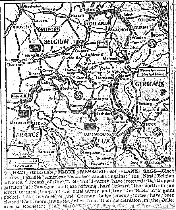
Map of Battle of the Bulge: Counter-Attacks against Nazi Belgian Advance;
Third Army Rescue of Trapped Troops at Bastogne, Driving North to Meet First Army;
Repulse of German Bulge from Celles Ten Miles to Rochefort, published December 29, 1944
![]()
![]()
Framed Edition
Links-Date -- Links-Subj.